

| | |
Fordyce Creek
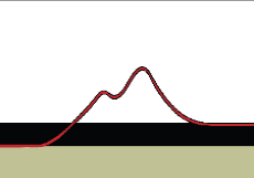
Fordyce Creek Flow Rate (Dreamflows)
Nevada County, California
Nevada County, California
Nearby Towns: Truckee
Nearby Trails: Rubicon Trail, Hell Hole Reservoir
Nearby Shops: Truckee Auto & 4x4 Parts, Trent's Fabrication & Auto Repair
Nearby Trails: Rubicon Trail, Hell Hole Reservoir
Nearby Shops: Truckee Auto & 4x4 Parts, Trent's Fabrication & Auto Repair
Directions
From Interstate 80 (Sacramento - 72.9 Miles)
- Head East on I80 toward Reno (70 Miles)
- Exit Eagle Lakes Road (Exit 164)
- Turn left over the freeway to the marked OHV trail head (2.9 Miles)
From Interstate 80 (Reno - 55.9 Miles)
- Head West on I80 toward Sacramento (53 Miles)
- Exit Eagle Lakes Road (Exit 164)
- Turn right and continue East to the marked OHV trail head (2.9 Miles)
To Interstate 80 (Trails End - Summit City - 32.2 Miles)
- Head North on Meadow Lake Road (9.3 Miles)
- Turn right at Henness Pass Road (8.8 Miles)
- Turn right onto Highway 89 South (14.1 Miles)
Often over shadowed by the neighboring Rubicon Trail, Fordyce Creek Trail
is never to be out done. While most would consider Fordyce Creek Trail to
be the most difficult in the Sierra's, nobody will argue it's ability to flood a
vehicle with 35" tires, on a low flow day. On high flow days the creek
remains impassable.
Fordyce Creek flow rate is controlled by Pacific Gas & Electric and can
change greatly, without warning and very quickly, stranding vehicle's behind
river crossings. Because of this it is recommended that the trail should be
run during the California Association of 4WD Clubs annual Sierra Trek.
During this time the flow rate is slowed to a safe 50cfs and no vehicle is left
behind.
| All other products, logos, brand names or companies are trademarks or registered trademarks of their respective companies. |
4x4TrailMaps All Rights Reserved
| | |