

Bartlett Springs Road
Mendocino National Forest (View this site)
Lake County, California
Lake County, California
Nice and Lucerne
Cow Mountain OHVA, Lake Pillsberry
Napa Auto Parts (Upper Lake)
Cow Mountain OHVA, Lake Pillsberry
Napa Auto Parts (Upper Lake)
Easy
24.5 miles (1.8 miles to Pinnacle Rock)
1,340' to 4,510'
Open All Year
Pinnacle Rock, Bartlett Springs Resort,
Indian Valley Reservoir
24.5 miles (1.8 miles to Pinnacle Rock)
1,340' to 4,510'
Open All Year
Pinnacle Rock, Bartlett Springs Resort,
Indian Valley Reservoir
Trail Photographs
(click to view full size)
(click to view full size)
Bartlett Springs Road is a great family trial and is suitable for stock vehicles.
Mendocino National Forest offers plenty of trails, hiking, camping and fishing.
Allow for a full day to run Bartlett Springs Road or stay the weekend and enjoy all
this area has to offer. The trail boasts some spectacular views and rich history.
During the winter months Bartlett Springs Road can become muddy, rutted with
the possibility of a snow pack conditions in the winter. Rain and snow may
quickly change road conditions. During heavy winters the road may also remain
impassable. As always plan you trip accordingly and for the unexpected.
Trail Head - Bartlett Springs Road begins a few miles outside of Lucerne. What
is known as the Barns Yard, previously walnut orchards, is now home to two
new wineries, as of 2004.
Tulip Hill Winery is located next to Bartlett Springs Road and resides in a
warehouse once used to bottle Bartlett Springs mineral water. The water was
loaded by truck in Bartlett Springs and trucked down the mountain to the bottling
warehouse. With similar soil characteristics to Napa Valley many wineries have
found their way to Lake County.
Mendocino National Forest - Mendocino National Forest is California's only
national forest not crossed by a paved road.
This fact makes this area very attractive for those seeking a great outdoor
experience miles from all. Bartlett Springs Road enters the forest in it's
southeastern edge and travels through its southern tip, offering Hundreds of
miles of trails, hunting, fishing, camping and breathtaking views will make this a
place to remember.
Deer Valley Road - Turn left here onto Deer Valley Road to Pinnacle Rock or
continue straight on Bartlett Springs Road to Indian Valley Reservoir and Bartlett
Springs Resort.
With elevations topping 4,500 feet it is not uncommon to experience ice and
snow. While not always visible at lake level Bartlett Mountain and surrounding
mountains may contain several feet of snow. At times the road may be
impassable do to snow fall. Plan you trip accordingly.
Service Road 16N01 - From Deer Valley Road turn right onto service road
16N01, as marked on the trail. This road is the least maintained of the trip.
There are some small ruts and while
four wheel drive is not usually required it may be necessary during the wet
months.
Pinnacle Rock - Pinnacle Rock acted as a fire station lookout through the
1940's. The rock steps circling to the top of pinnacle rock and an anchor within
the rocks peak are the only evidence left behind.
From this vantage point one can survey most of the southern tip of Mendocino
National Forest. On a clear day the Sutter Buttes can be seen to the east, over
50 miles away!
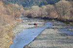
North Fork Bartlett Creek - The crossing at North Fork Bartlett Creek has the
option of fording the creek or crossing a small bridge. While the creek depth is
shallow here it may require four wheel drive and the depth greatly increases in
the winter and spring. Use caution and always scout unknown water crossings.
Bartlett Springs Resort - During the late 1800's natural springs became a very
popular tourist destination and Bartlett Springs was no exception. Construction
began in 1870 and during its prime Bartlett Springs Resort was known as a first
class resort with five hotels, 350 cabins, a large gazebo for entertainment,
mineral spring pools and other buildings serving its one thousand guest
capacity. In 1934 a wildfire destroyed the resort and the idea of rebuilding was
abandoned. Today only a few structures remain including some cabins, the
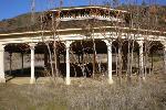
gazebo and pool foundations.
Indian Valley Reservoir - Indian Valley Reservoir is known for its great Kokanee
Salmon and Rainbow Trout fishing. While the long dirt road and motorboat
restrictions, under 10MPH, keep the crowds to a minimum. There is primitive
camping around the lake as well as great ATV, dirt bike and more challenging
4x4 trails.
A marina and store is located near the dam at the south, opposite, end of the
lake. Although the lake is usually full during the winter and spring months it can
become very low during the summer. Walker Ridge Road can be used for
easier access to the lake from highway 20.
Trail Maps
Waypoint Coordinates
(click to download)
(click to download)
39° 06' 47.4" N 122° 49' 08.7" W
39° 07' 00.3" N 122° 47' 57.4" W
39° 08' 03.7" N 120° 46' 36.7" W
39° 09' 03.4" N 120° 46' 17.9" W
39° 08' 51.9" N 120° 45' 54.4" W
39° 10' 54.9" N 120° 43' 07.5" W
39° 11' 01.0" N 120° 42' 15.0" W
39° 09' 11.4" N 120° 32' 54.5" W
39° 07' 00.3" N 122° 47' 57.4" W
39° 08' 03.7" N 120° 46' 36.7" W
39° 09' 03.4" N 120° 46' 17.9" W
39° 08' 51.9" N 120° 45' 54.4" W
39° 10' 54.9" N 120° 43' 07.5" W
39° 11' 01.0" N 120° 42' 15.0" W
39° 09' 11.4" N 120° 32' 54.5" W
Trialhead
Mendo. National Forest
Deer Valley Road
Service Road 16N01
Pinnacle Rock
N. Fork Bartlett Creek
Bartlett Springs Resort
Indian Valley Reservoir
Mendo. National Forest
Deer Valley Road
Service Road 16N01
Pinnacle Rock
N. Fork Bartlett Creek
Bartlett Springs Resort
Indian Valley Reservoir
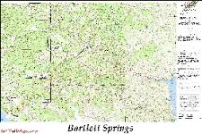
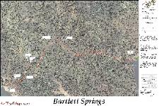
USGS basemap
36" x 54"
8.91MB (PDF)
4.52MB (JPG)
11" x 17"
1.9MB East - West (PDF)
2.4MB East - West (JPG)
36" x 54"
8.91MB (PDF)
4.52MB (JPG)
11" x 17"
1.9MB East - West (PDF)
2.4MB East - West (JPG)
36" x 54"
16.4MB (PDF)
8.28MB (JPG)
11" x 17"
10MB East - West (PDF)
2.0MB East - West (JPG)
GPS Waypoints (GPX)
GPS Track (GPX)
Bartlett Springs Trail & Waypoints (Google Earth)
Mendocino National Forest - Map Overlay (Google Earth)
Mendocino National Forest (National Forest Service)
Bartlett Mountain (USGS 24K TOPO)
Bartlett Springs (USGS 24K TOPO)
Benmore Canyon (USGS 24K TOPO)
Clear Lake Oaks (USGS 24K TOPO)
Hough Springs (USGS 24K TOPO)
Lucerne (USGS 24K TOPO)
Directions
- Head North on Interstate 5 to Williams (55 Miles)
- Exit West on Highway 20 (approximately 53 Miles)
- The trailhead is on your right, next to Tulip Hill Winery on Bartlett
Springs Road. (1.2 Miles beyond Lucerne)
From Bay Area (104 Miles)
- Head East on Interstate 80 to North Highway 29
- Go North on Highway 29 for approximately (71 Miles)
- Continue North on Highway 53 for approximately (7.5 Miles)
- Turn left, West, on Highway 20 (16 Miles)
- The trailhead is on your right, next to Tulip Hill Winery on Bartlett
Springs Road. (1.2 Miles beyond Lucerne)
| All other products, logos, brand names or companies are trademarks or registered trademarks of their respective companies. |
4x4TrailMaps - All Rights Reserved
| Difficulty Rating: Total Trail Length: Elevation Change: Operating Season: Points of Interest: |
| Nearby Cities: Nearby Trails: Nearby Shops: |
Please allow a few moments to load...
Click the trails and other points of interest for additional information. This map is avalible for download in the "Trail Maps" section.
